

Acknowledgements
We would like to express our thanks to those individuals that contributed their time and effort to various aspects of this document. These persons include Mike Bayless, Ron Dent, Joe Bonneau, Todd Gemeinhardt, Bob Mattucks, Jeremy Russell, Alex Schubert, and Kevin Sullivan. In addition several individuals contributed to the review process. These persons include Robert DiStefano, Pam Lanigan, Monte McQuillen, Bill Turner, and members of the MDC Kansas City Region RCT. Thanks to these, and any other previously unmentioned contributors.
Executive Summary
The South Grand River Watershed occupies a land area of approximately 2,046 square miles in portions of 8 counties in Missouri and 2 Counties in Kansas. These counties include Bates, Benton, Cass, Henry, Jackson, Johnson, Pettis, and St.Clair Counties in Missouri and Johnson and Miami in Kansas. Most of the watershed (98.5%) lies within Missouri. The watershed is bounded to the West and Southwest by the Maries des Cygnes Watershed and to the South and East by the Upper Osage Watershed both of which have been combined as the West Osage Basin in the West Osage Basin Inventory and Management Plan. The Lamine and Blackwater Watersheds border the South Grand on the northeast side while the Missouri River Mainstem Drainage borders the watershed to the north.
The South Grand River is formed by the confluence of Massey Creek and East Creek approximately 5 miles southwest of Peculiar, Missouri. From its beginnings the river flows in a southeasterly direction for approximately 28 miles before turning to flow East for another 16 miles. It once again turns to a southeasterly direction and continues for another 9 miles before receiving the flow of Big Creek, the largest tributary to the South Grand. From this point, the South Grand continues in a general southeast direction for approximately 14 miles before emptying into Harry S. Truman Reservoir near Clinton, Missouri. The South Grand River Watershed has 13 cities and towns with populations exceeding 1,000 persons within or partially within its boundary. These included Adrian, Belton, Clinton, Garden City, Greenwood, Harrisonville, Holden, Kansas City, Lee's Summit, Peculiar, Pleasant Hill, Raymore, and Windsor. All of these are within Missouri.
The South Grand River Watershed lies within the Osage Plains Subdivision of the Central Lowland Physiographic Region. The Osage Plains Subdivision is comprised of gently rolling plains with scattered escarpments, low mounds and a low relative relief of 50-150 feet. The Osage Plains were not glaciated, unlike much of the Central Lowlands Physiographic Region. Elevations within the South Grand River Watershed range from a maximum of approximately 1,154 feet msl in the uplands to approximately 682 feet in the lower portions of the watershed. South Grand River Watershed occurs primarily within the Cherokee Prairies Soil Region. Eleven soil associations occur within the watershed.
The geology of the South Grand River Watershed consists primarily of limestone and sandstone of Pennsylvanian age. Upland portions of the watershed are overlain by up to six feet of loess. Pennsylvanian aged clay also occurs in smaller, more isolated areas of the watershed. In the lower portion of the watershed, Mississippian limestone, limestone shale, and Ordovician dolomite are present. The presence of barriers to groundwater infiltration such as clay and shale within the Pennsylvanian bedrock as well as the limited storage capacity of the bedrock in the area have resulted in very few springs as well as poorly sustained stream baseflows in dry periods.
There are 186 third order and larger streams within the watershed. The South Grand is 66.4 miles long and becomes seventh order at the confluence of Big Cr.
Total drainage area of the South Grand River Watershed is 2,046 square miles or 1,309,440 acres. The drainage area of the watershed in Missouri is 2,016 square miles or 1,290,240 acres. In order to facilitate analysis of various watershed characteristics within this document, the watershed was divided based on eleven digit hydrologic units. The largest of these units is the Middle South Grand Unit which drains approximately 418 square miles (267,449 acres).
Channel gradient was determined for all fourth order and larger streams within the South Grand River Watershed using data digitized from USGS 7.5 minute topographic maps. The South Grand River has an average gradient of 1.9 feet/mile.
Historical land cover within the uplands of the South Grand River Watershed primarily consisted of prairie with oak savannas and open oak woodlands in the more dissected areas along and near streams. In the portion of the watershed which is now in the area of lower Truman Reservoir, a landscape more typical of the Ozarks was present. The uplands were dominated by oak savanna and open oak woodlands. Scattered dolomite and sandstone glades as well as occasional prairie openings were also originally present in this area. Analysis of recent land cover data reveals that approximately 52.2% of the South Grand River Watershed today is grassland. Crop land is the second most prevalent land cover accounting for approximately 26.5% of the total watershed area, while forest is third at 18.2 %.The land cover categories of wetland and water each account for approximately 0.1% and 2.7% respectively.
The 2000 human population within the South Grand River Watershed was estimated to be 110,855 persons. Population density in 2000 was approximately 54 persons per square mile as compared to the overall population density for Missouri which was approximately 81 persons per square mile.
Average annual precipitation within the South Grand River Watershed is approximately 41.0 inches. The United States Geological Survey (USGS) currently (2002) has two active surface discharge gaging stations within the South Grand River Watershed. The annual daily mean discharge of the South Grand River near Clinton is 1,329 cubic feet per second (cfs).
Many streams within the South Grand River Watershed suffer from water quality problems. Eight streams and 2 reservoirs are included in the 1998 303d listing of impaired waters. Most streams on the impaired list have impacts related to coal mining activities in the watershed. There are additional streams in the watershed not included on the list, but which are impacted to some degree by channel alteration, sedimentation, and pollutants associated with runoff from agricultural land. Thirty one water pollution incidents have been investigated in the South Grand River Watershed since 1990. Fourteen of the 31 incidents resulted in fish kills. Half of the fish kills were associated with discharges from sewage treatment facilities.
Several streams within of the South Grand River Watershed, including the South Grand River and Big Creek, are highly altered. Extensive channelization an leveeying has occurred on large portions of these streams as well as in some other areas. Inundation by Truman Reservoir has eliminated or impacted many stream miles in the lower portion of the watershed including 39% of the original South Grand River. Estimates based on National Wetlands Inventory data reveal that 469 diked and/or impounded waters also occur within the South Grand watershed. Riparian corridor land cover within the South Grand River Watershed consists of more grassland/cropland (60.4%) than forest/wetland (37.5%). The riparian corridor of the South Grand River does not reflect the overall riparian land cover of the watershed. Estimated combined forest and wetland for the river is 70.3% and 20.5% for combined grassland and cropland.
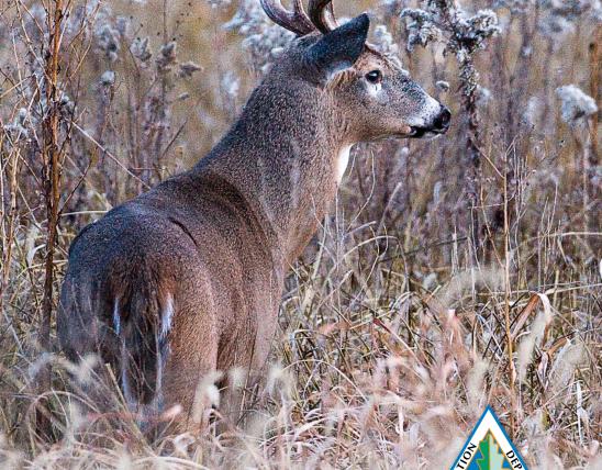
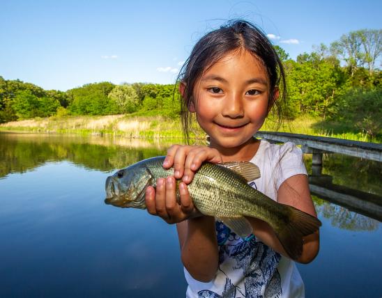
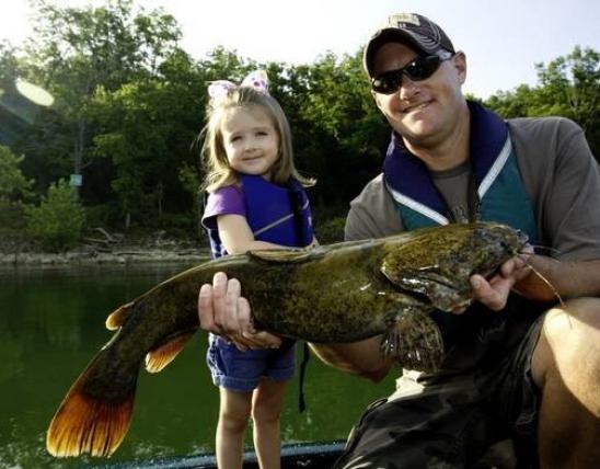
Sixty fish species in 15 families have been recorded in the South Grand River Watershed since 1940. Thirteen species comprise the game fisheries of the watershed. These include spotted bass, largemouth bass, white crappie, black crappie, blue catfish, channel catfish, flathead catfish, white bass, striped bass, walleye, and paddlefish. In addition, 15 species of mussels, 9 species of snails, two species of crayfish, and 183 taxa of benthic invertebrates as well as 22 specie of concern have been recorded in the watershed.
The management goals, objectives, and strategies for the South Grand River Watershed were developed using information collected from the South Grand River Watershed Inventory and Assessment (WIA) and direction provided by the Missouri Department of Conservation (MDC) West Central Regional Management Guidelines (1998), Kansas City Regional Management Guidelines 1999, Missouri Department of Conservation Strategic Plan, and the Fisheries Division Five Year Strategic Plan. Objectives and strategies were written for riparian and aquatic habitat, water quality, aquatic biota, and promotion of public awareness and use. All goals are of equal importance. These goals include
- protect and improve riparian and aquatic habitats in the South Grand River Watershed,
- Protect and improve water quality in the South Grand River Watershed,
- Maintain the abundance, diversity, and distribution of aquatic biota at or above current levels while improving the quality of the game fishery in the South Grand River Watershed, and
- increase public awareness and promote wise use of aquatic resources in the South Grand River Watershed.