


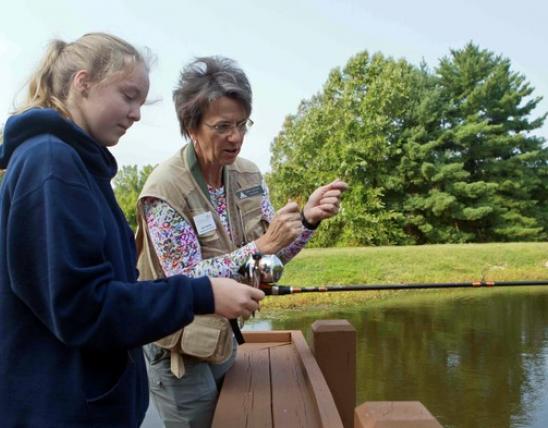


The Missouri Department of Conservation manages more than 1 million acres of land, which makes up more than 1,000 conservation areas spread across our wide state. Though each area is unique in size, offerings, and amenities, they all offer adventure. You can find one close to home for a quick getaway or one not too far away if you’re interested in a staycation.
Whatever your pleasure, MDC has you covered! Use the MO Outdoors app, available free for Android or iPhone, to help find the perfect area for you. Find conservation areas, determine activities available, learn the area’s regulations, download maps, and more. For more information, visit short.mdc.mo.gov/ZeD.
To help get you started as you plan your own outdoor fun, six staff from the Missouri Conservationist chose a different area to visit and review.
Lead Mine Conservation Area
Larry Archer said:
Looking for a quick “first-day” hike in early January, I landed at Lead Mine Conservation Area in Dallas County. First, a word of warning: plan your visit carefully. This place is huge, and a person can waste a lot of time driving around looking for a trailhead. With planning, though, a person can spend hours on the network of trails that run throughout the area. Many of these trails are multiuse, so watch your step because it’s obvious they get plenty of use from horses.
With its hilly terrain, the trail I hiked through the Niangua River Hills Natural Area gave me a great workout, but given the size of this place, I didn’t even begin to put a dent in exploring it all, so I’m going to make a point of going back.
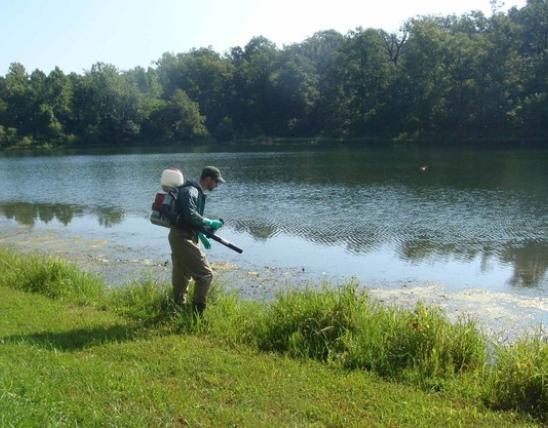
With a couple miles of Niangua River frontage and two boat ramps, Lead Mine Conservation Area would also be a good place to launch a day on the water — just not in January (unless you’re into that sort of thing).
7,760.7 acres in Dallas County. From Plad, take Highway 64 west, then Route T north, then Route YY east 0.5 mile.
short.mdc.mo.gov/4kb
417-895-6880
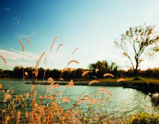
Fountain Grove Conservation Area
Matt Seek said:
I lit out before sunrise on the first warm day of March. My kids and wife were home for spring break, and our usually quiet and empty house had grown boisterous. I needed a distraction-free spot to wrap up a writing assignment, and Fountain Grove Conservation Area seemed like a peaceful sanctuary for wordsmithing.
Wow was I spectacularly wrong.
Located 5 miles down a dead-end blacktop, in the floodplain of the unruly Grand River, the area offers nearly 8,000 acres of mosquito-humming marshes and soggy, bottomland forests.
I pulled into a picturesque parking lot at daybreak, rolled down my window, and shut off the car. Immediately, I was assaulted with the cacophony of a spring marsh in the throes of peak migration.
Wings whistled overhead as squadrons of waterfowl jockeyed to land in the smartweed-dotted pool that stretched outside my windshield. Happy ducks chuckled and quacked about their good fortune at finding room and board for the day, while Canada geese squabbled and honked over territorial boundaries. The musical peeps of lovesick amphibians and the calls of skittering shorebirds rounded out the symphony.
I quickly shelved hope of getting any writing done, pulled out my binoculars, and spent the rest of the morning enjoying the company of ducks, geese, and other winged wanderers.
The downside? Once I returned home, I had to work into the wee hours of the night to meet my writing deadline. But I’d gladly make the trip again.
If you visit in the fall, be aware that large swaths of Fountain Grove are closed to non-hunters during waterfowl season. It’s a good idea to review the information on the area’s webpage and print out a map before you depart.
I took off half a star for false advertising — though I crisscrossed the area from one soggy corner to the other, I found neither fountains nor groves.
Get out and discover a conservation area near you! What kind of review will you give it?
7,959 acres in Linn and Livingston counties. From the Meadville intersection on Highway 36, take Route W south for 5 miles, then continue south on Blackhorn Drive for less than a mile to reach the area headquarters.
short.mdc.mo.gov/4kH
660-646-6122
Blue Spring Branch Conservation Area (the Ball Mill Resurgence Natural Area specifically)
Stephanie Thurber said:
This place hit the spot for our family and friends wanting to get out for some spring hiking. We were trying to go to Seventy-Six Conservation Area, but on the day we went, the river was too high to cross into the area. So, we used the MO Outdoors app to quickly find a new spot nearby, and the navigation took us directly to the parking lot for the Ball Hill Resurgence Natural Area on the Blue Spring Branch Conservation Area.
As soon as we got out of the car, we were able to find perfect hiking sticks, so big points for that. Only reason for taking one star off is because we weren’t sure how long the trail was. With our kids being 5 and 8, this was important info to know — an extra quarter of a mile could mean the difference between the kids carrying all their necessities, or us carrying the kids plus all their necessities. It ended up being about a mile. Also, no bathrooms. But we did know that part going in.
The looped trail in the natural area was great for our little explorers. We saw some turtles sunning on a pond log right away. The kids identified ferns, saw spring beauty flowers blooming, and felt moss along the tree trunks. We all enjoyed learning about the sinkholes from the signs, and we even found one that was heart-shaped. The highlight of the trail for us was the Ball Mill Resurgence. The kids couldn’t resist adding a few rocks from the creek bed into the conduit.
If you’re looking to ease into hiking in southeast Missouri, this is your place.
475 acres in Perry County. From Perryville, take Highway 61 north, then Route V north until the pavement ends, and follow County Road 916 into the area.
short.mdc.mo.gov/4kB
573-290-5730
Painted Rock Conservation Area
Angie Daly Morfeld said:
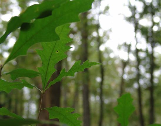
Painted Rock Conservation Area is a favorite for my family. It is close to home, so it offers an easy escape and a multitude of outdoor experiences and opportunities. My favorite activity is hiking the Osage Scenic Bluff Trail in the fall, which is what my son and I did on this particular visit.
The trail is well-maintained and easily traversed. Accessing the trail from the parking area, you are immediately engulfed in towering trees — primarily oaks and hickories. My son got a kick out of the size of one large leaf, kissed with the colors of autumn, shed from one of these mighty trees. He picked it up from the ground and held it next to his face, and marveled that it was larger than his head!
As you walk along the trail, you are treated to the history of the area. An Indian burial cairn, constructed between 500 and 1,500 years ago, sits along the trail, a reminder of the area’s occupants as early as 9,000 years ago.
But, for me, the greatest attribute of the trail and the area is the boardwalk at the west boundary of the property that overlooks the Osage River. When you stand on the boardwalk, you get an unrestricted view of the river, the bluff, and trees so alive with the rich reds, golden yellows, and vibrant oranges of autumn.
Painted Rock is a thrill no matter the season you visit. Wildflowers bloom from May to October. The area contains six ponds for fishing and 60 acres managed for wildlife food plots. Deer and turkey hunting is allowed, as is trapping by special use permit.
1,479 acres in Osage County. From Westphalia, take Highway 63 north, then Highway 133 west 7 miles to the area.
short.mdc.mo.gov/4k2
573-897-3797
Earthquake Hollow Conservation Area
Cliff White said:
If I was a real estate agent, and Earthquake Hollow Conservation Area was a house, I’d be describing it as a cozy bungalow. That is to say, it’s small. But, just like a good cozy bungalow, what Earthquake Hollow lacks in size, it more than makes up for with charm.
The distinguishing feature of this area located in Callaway County is the “hollow,” a canyon like ravine that borders the area on three sides. It is as much as 200 feet from ridge top to the floor of the hollow in places. The area brochure describes the walls of this ravine as one of the best examples of a chert conglomerate cliff in Missouri. I don’t know what that means, other than you are in for some steep, rocky, rough terrain if you choose to descend into the hollow. However, if you are fit and careful, a descent into the ravine will reward you with fantastic views of the cliffs and surrounding wooded slopes.
The only trail on the area is a short path that follows the ridge from the parking lot into the middle of the area. At that point, you can enjoy the view from the top, or tackle the challenge of descending into the hollow.
The area is primarily wooded and might be kind of brushy in the summer. I visited in the spring, during the magic conjunction of the blooming of the redwoods and dogwoods. It was beautiful. I suspect the area has some great fall colors as well. I have not personally hunted on the area, but the area brochure suggests hunting for deer, turkey, rabbit, and squirrel are all good options. Due to the small size of the area, however, firearms firing a single projectile are prohibited.
If you are in central Missouri, looking for some interesting scenery, and want to get away from the crowds of larger, more popular conservation areas, Earthquake Hollow is worth a visit.
87 acres in Callaway County. From Holts Summit, take Highway 54 north for 2 miles, then Route TT east 1 mile, then County Road 452 east 1 mile to the area.
short.mdc.mo.gov/4k8
573-815-7900
Julian Steyermark Woods Conservation Area
Bonnie Chasteen said:
If you love Missouri’s woodland wildflowers, plan to visit this little urban conservation area in the spring. It’s a must-see if you live in Hannibal and worth the drive if you’re coming from St. Louis or Columbia.
Before leaving Columbia, my hiking pal and I downloaded and printed the area map from the website. We had no trouble finding the parking lot along the Mississippi River on the northeast side of Hannibal.
Beyond the parking lot, a park-like sweep of mown grass under a canopy of tall trees lures visitors toward the trailhead. There, you can choose to start the loop trail hiking uphill or along the bottomland.
We chose the uphill branch and weren’t disappointed. Sweet William, jack-in-the-pulpit, trillium, bloodroot, and other spring woodland flowers bordered the climb. Soon the narrow path led us into a sheltered gorge walled with limestone. We spotted semicircular veils of maidenhair fern, and, higher up on the ridgeline, two stalks of Adam and Eve orchid. This was a personal first for me — I’d only ever seen the withered leaves of this orchid in the winter.
For my pawpaw-loving friend, the highlight was the many patches of pawpaw growing and blooming almost the whole length of the trail. “There will be lots of fruit in August,” she said.
“If the critters don’t get it first,” I said.
Regardless, we agreed to head back in October to see what the area looks like in fall color.
Whenever you go, take a pair of hiking poles — the narrow trail can be tricky, especially along the bluffy drop-offs. Also, keep an eye out for poison ivy.
The area map shows a loop trail, and, for the most part, the trail is well-marked. Some new trails cut across the loop, but these are less well-marked, which is why I didn’t give it a full five-star rating.
We saw patches of urban invasives like Chinese bittersweet, wintercreeper, and bush honeysuckles, but we were also pleased to see evidence of efforts to control them.
73 acres in Hannibal. From Hannibal, take Highway 168 north, then County Road 410 east 1 mile.
short.mdc.mo.gov/4kX
573-248-2530


Also In This Issue

Beautiful spider with an ugly reputation.

Bird declines and why we must act now.
And More...
This Issue's Staff
Editor - Angie Daly Morfeld
Associate Editor - Larry Archer
Photography Editor - Cliff White
Staff Writer - Kristie Hilgedick
Staff Writer - Joe Jerek
Staff Writer – Dianne Van Dien
Designer - Shawn Carey
Designer - Marci Porter
Photographer - Noppadol Paothong
Photographer - David Stonner
Circulation - Laura Scheuler